
 Get Audio+
 Hot FM
 Kool 101
 Eight FM
 Fly FM
 Molek FM
What Caused The Viral ‘Mini Tornado’ In Damansara This Week?
 Thirsty for JUICE content? Quench your cravings on our Facebook, Instagram, TikTok and WhatsApp
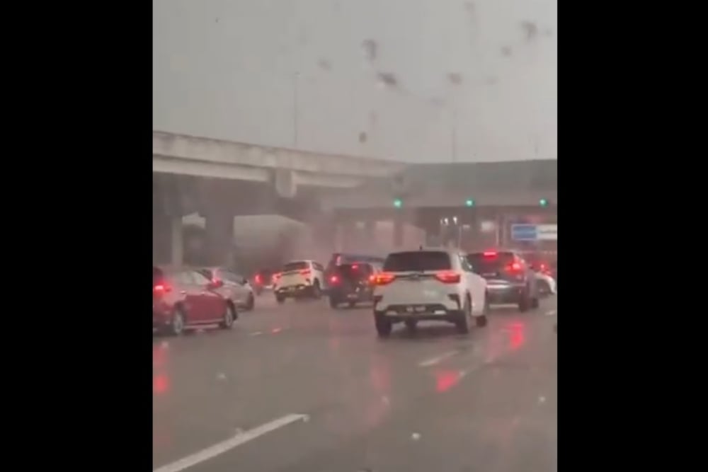
A ‘mini tornado’ that swept through Damansara, Selangor, on 13 October was caught on video, with footage of the phenomenon circulating widely on social media.
The Malaysian Meteorological Department (MetMalaysia) has since attributed the landspout to active thunderstorm clouds, also known as cumulonimbus clouds.
MetMalaysia director-general Dr Mohd Hisham Mohd Anip said the phenomenon forms when wind shear and rising air currents interact as thunderstorm clouds develop.
Watch the clip here.
These small-scale tornadoes are difficult to detect using weather radar and satellites due to their brief lifespan and limited size.
In Malaysia, they typically measure less than 10 metres across and last only a short time.
MetMalaysia had issued a thunderstorm warning for parts of Selangor at 5.30 p.m. on 13 October, the same day the incident occurred.
Mohd Hisham added that landspouts and waterspouts are more common during the monsoon transition periods, particularly from March to May and September to October, when humid, unstable atmospheric conditions, along with weak winds blowing from different directions, create favourable conditions for their formation.
While landspouts in Malaysia are generally smaller and weaker than the powerful tornadoes often seen in the United States, they can still cause localised damage and injuries. Strong winds can send debris flying, damage structures, and pose risks to motorists, making it important to seek shelter indoors and stay away from windows if one forms nearby.
Despite their short lifespan, these phenomena should not be taken lightly, especially given how quickly they can develop.
For more news, click here.
Follow JUICE on Facebook, Instagram, and TikTok.

Missed these?
“Too Much”: Netizens Fear TikTok Trend That Pranks Kids With Kuntilanak Audio Is Traumatising & Extreme
Maybe try the other TikTok trends instead?
Local Actress Bodyshamed By Netizens And Brought To Tears While Filming ‘Live’ Makeup Tutorial
Netizens can be ruthless.

“My Nipples Are Swelling”: Netizens Spam Local Athlete’s Instagram Post With Obscene Comments
He has now deleted the comments…